Draw the plot boundary, get it from the land registry, or make it as a rectangle around the house. The distance from each building to the boundary shows on every side, on the ground floor, in the site plan of the export and in the measuring report.
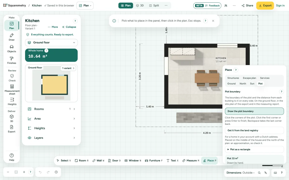
Plot boundary and site plan: step by step
1. Open the Plot tab
In Plan, click More in the toolbar and pick Plot under Outside, with Driveway and garden, Ground and North next to it. Or press P and choose the tab Plot.
2. Draw or get the boundary
Click Draw the plot boundary and click the corners of the plot; click the first corner or press Enter to finish. Signed in, with a Dutch address, Get it from the land registry places the plot from the Kadaster map on the middle of the house and the north of the plan: check where it lies. A plot with another plot inside it comes with that inner boundary: it shows as a boundary and does not count in the plot area. If the land registry map does not answer or has no plot at the address, a sentence says so: try again later or draw the boundary yourself. Or open Plot as a rectangle and type the distance to the boundary on each side.
3. Read the distances
The plot area and, on each side (top, right, bottom, left), the distance from the outside of the buildings to the boundary they face on that side, measured at right angles to that boundary, show in the tab and on the plan as dimension lines. The far edge of a neighbouring plot and a boundary diagonally beside the building do not count. If the building touches or crosses the boundary, that side says 0 m, on the boundary, with a message; within 1 cm (5 cm for a plot from the land registry map) counts as on the boundary. If the building touches a neighbouring plot at a corner, Squaremetry reports it on the side where it reaches in; the other sides are measured as usual. If the building stands over another plot, one message says so. A side without a boundary in front of the building says so. A building entirely outside the plot does not count in the distances of the others; the message names it. A plot from the land registry map is approximate and rounded to 0.1 m.
4. Driveway and garden
Click Driveway or Garden and click the corners, like any area. Paving or grass is set for you.
5. In the export and the report
Export all floors (with an unlocked home, Pro or Team): the site plan comes first, with the boundary, distances and heights. The drawing set has a Site plan sheet. The measuring report lists the plot and the distances on its site page.
Messages you may see
- Plot boundary added from the land registry. Check where it lies.
- Sign in and add this home to your account to get the plot from the land registry.
- Draw the house first: the distances are measured from its walls.
- The building stands over another plot. Check where the plot lies.